Exploring the Villages, Passes, and Landmarks of the Everest Khumbu Region

Table of Contents
The Everest (Khumbu) region of Nepal is one of the most iconic trekking and mountaineering destinations in the world, home to the towering Mount Everest and a vibrant Sherpa culture. Beyond the majestic peaks, the region is dotted with charming villages, sacred monasteries, breathtaking high passes, and glacial landmarks that together form an unforgettable Himalayan experience. Here’s a comprehensive guide to the key villages, places, passes, and landmarks in the Khumbu and its surrounding areas.
Villages and Settlements
The journey into the Khumbu usually begins at Lukla, a bustling mountain town famous for its small but thrilling airport, known as the gateway to Everest. From Lukla, trekkers pass through Phakding, a riverside settlement nestled along the Dudh Koshi River, offering beautiful views and cozy lodges. Further along the trail lies Monjo, the entrance point to Sagarmatha National Park, where trekkers register their permits.
Climbing higher, you reach the iconic village of Namche Bazaar, the Sherpa capital of the Khumbu, situated in a horseshoe-shaped amphitheater surrounded by mountains. Namche is the main hub for acclimatization, shopping, and experiencing Sherpa hospitality. Beyond Namche, the trail splits toward Thame, a serene and less-trodden village westward, known for its monastery and connection to mountaineering legends like Tenzing Norgay.
Continuing northward from Namche, trekkers encounter Khumjung and Khunde, twin Sherpa villages set beneath the sacred peak of Khumbila, offering a glimpse of traditional lifestyles and hosting the famed Khumjung Monastery. From here, trails lead to Phortse, a quieter village favored by climbers, and then to Pangboche, home to the oldest monastery in the Khumbu and a spiritual heart of the region.
Higher up lies Dingboche, a broad, windswept village surrounded by stone walls and potato fields, ideal for acclimatization days. North of Dingboche is Pheriche, another acclimatization stop with a Himalayan Rescue Association post. As you move toward Everest Base Camp, you pass through Lobuche, a small cluster of lodges, and finally Gorak Shep, the last settlement before reaching the base of Everest.
In the Gokyo valley, west of the main trail, you’ll find Dole, Machhermo, and the stunning Gokyo Village, located by the turquoise Gokyo Lakes and at the foot of Gokyo Ri.
High Passes
The Khumbu region is also renowned for its high-altitude passes, offering adventurous routes and dramatic panoramas. The three most famous passes form the Everest Three Passes Trek:
-
Kongma La (5,535 m), connecting Lobuche with Chhukung, is the highest and perhaps the toughest of the three, offering commanding views of the Khumbu Glacier and surrounding peaks.
-
Cho La (5,420 m) links Dzongla and Thagnak, taking trekkers over icy terrain between the Everest and Gokyo valleys.
-
Renjo La (5,360 m) connects Gokyo with the Thame valley, offering one of the most spectacular vistas of Everest, Lhotse, Makalu, and the Gokyo Lakes below.
Another important pass in the area is Tashi Lapcha Pass, which lies west of Thame and connects the Rolwaling Valley with the Khumbu — a challenging and less-traveled route.
Key Landmarks and Sacred Sites
Besides the villages and passes, the Khumbu region is dotted with culturally and spiritually significant landmarks. The Sagarmatha National Park Headquarters in Namche provides information on the region’s ecology and mountaineering history. The Tengboche Monastery, perched on a ridge, is perhaps the most famous religious site, hosting the annual Mani Rimdu festival and offering panoramic views of Ama Dablam and Everest.
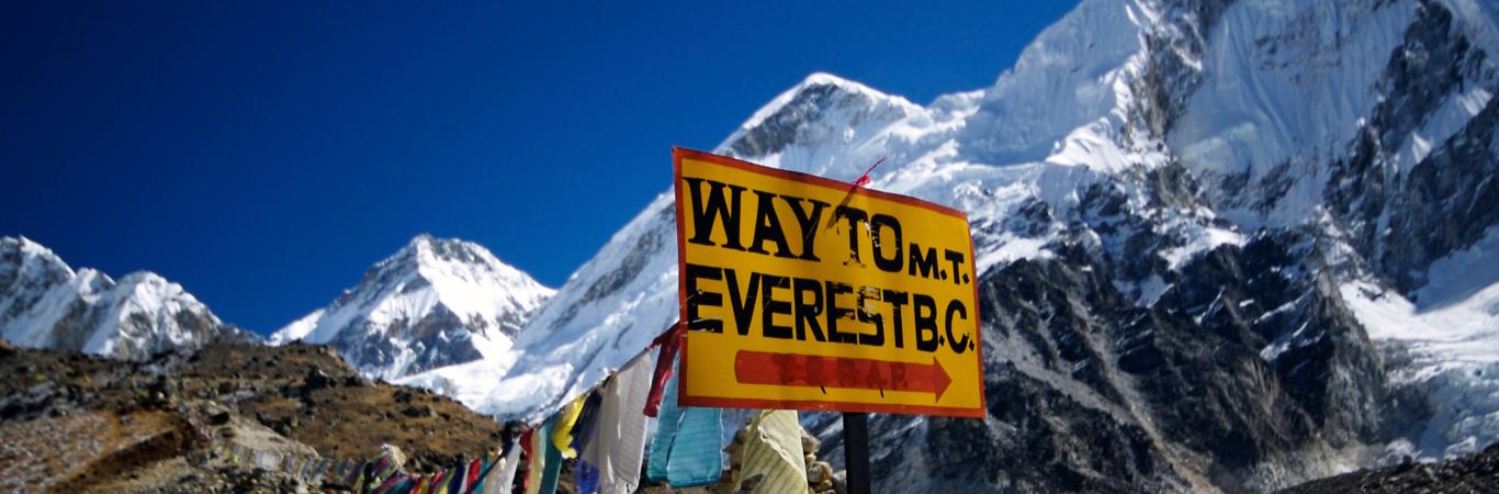
The Khumbu Glacier and the Khumbu Icefall are dramatic features on the way to Everest Base Camp, showcasing the powerful forces of nature at work. Nearby, the Everest Base Camp (5,364 m) itself is a landmark where climbers gather before their summit attempts. Another must-see is Kala Patthar (5,545 m), the best viewpoint for close-up views of Everest.
On the Gokyo side, the Gokyo Lakes are a sacred collection of glacial lakes, with the fifth lake offering especially breathtaking views of the Everest massif. The Gokyo Ri (5,360 m) is another famous vantage point, providing unforgettable sunrise and sunset scenes.
1. Jiri to Lukla Route Description
(Also called the Classic Hillary-Tenzing Route)
The Jiri to Lukla trek is a legendary route that retraces the footsteps of Sir Edmund Hillary and Tenzing Norgay during their first successful Everest expedition in 1953. Starting from Jiri (1,905m), a charming hill town in Dolakha district, the trail winds through lush mid-hill forests, terraced farmlands, and traditional Sherpa and Rai villages.
From Jiri, the path descends to the serene village of Shivalaya (1,770m), nestled by a riverside. A steady uphill climb then takes trekkers to Deurali, a small ridge-top settlement offering early views of the eastern Himalayas. The trail continues to Bhandar (also spelled Bandar), a peaceful village known for its terraced fields and local cheese.
Descending steeply to Kinja (1,630m), trekkers cross the Likhu Khola river before beginning a rigorous ascent to Sete(2,575m), a small village surrounded by rhododendron forests. The route then leads to Lamjura La Pass (3,530m), the highest point on this section of the trail, often shrouded in mist and famous for its blooming rhododendrons in spring.
After crossing the pass, the trail descends to Goyam and then continues to the picturesque village of Junbesi (2,700m), one of the cultural highlights of the trek. Nearby lies the Thuptenchholing Monastery, a serene Tibetan Buddhist monastic complex perched above the valley.
From Junbesi, the trail climbs gradually to Ringmo, then ascends further to cross Taksindu La Pass (3,071m), marked by colorful prayer flags and offering panoramic Himalayan views. A short descent brings trekkers to Taksindu, known for its cheese factory and friendly lodges. The next stop is Nunthala (also called Manidingma), a lower-altitude village with beautiful views of terraced hills.
The trail then continues down to Jubing, crosses several suspension bridges, and begins a long uphill stretch to Khari Khola (2,010m), a large Rai and Sherpa settlement. After a brief descent and another climb, the trail reaches Bupsa(2,360m), a small settlement perched on a steep slope.
Next is Paiya (also known as Chutok), offering first glimpses of aircraft flying into Lukla. The path descends to Surke, a quiet riverside village located directly below Lukla. A final steep climb through forested trails brings trekkers to Cheplung and then finally to Lukla (2,860m), the gateway to Everest and the end (or beginning) of many classic Khumbu treks.
Jiri to Lukla Route — Place by Place Brief
| Place Name (Altitude) | Description |
|---|---|
| Jiri (1905m) | Starting point of the classic Everest trek. A bustling hill-town with hotels, shops, and beautiful terraced farms. |
| Shivalaya (1770m) | Peaceful riverside village with lodges, a checkpoint, and views of rolling hills. |
| Deurali (~2705m) | A small ridge-top village surrounded by forests; great mountain and valley views. |
| Bhandar / Bandar (2200m) | Charming village with stone houses, fields, and a quiet monastery. |
| Kinja (1630m) | Located in a deep valley beside a river, a good place to rest before the steep climb to Sete. |
| Sete (2575m) | A small hamlet in dense rhododendron forest, famous for spring flowers. |
| Lamjura La Pass (3530m) | The highest point before Lukla. Covered in mist and prayer flags, known for rhododendron blooms. |
| Goyam (~3220m) | A tiny cluster of houses after Lamjura, with pastures and yak grazing nearby. |
| Junbesi (2700m) | One of the most beautiful Sherpa villages, with a monastery and cheese factory. |
| Thuptenchholing Monastery (2920m) | A large Buddhist monastery above Junbesi, home to many monks and nuns. |
| Ringmo (2800m) | A quiet village with stone walls and lodges, halfway to Taksindu. |
| Taksindu La (3071m) | Scenic pass offering wide Himalayan views, adorned with colorful prayer flags. |
| Taksindu (2960m) | Known for its cheese factory, friendly teahouses, and monastery. |
| Nunthala / Manidingma (2330m) | A charming Sherpa village nestled among terraced fields and pine forests. |
| Jubing (1680m) | A lower-altitude, warm village surrounded by farmland and waterfalls. |
| Khari Khola (2010m) | One of the larger Rai-Sherpa villages on the route, with many lodges and a vibrant community. |
| Bupsa (2360m) | Perched on a hillside, this is a quiet stop with beautiful sunrise views. |
| Paiya / Chutok (2730m) | Set in a small clearing with basic lodges, surrounded by forest and ridges. |
| Surke (2290m) | A riverside village directly below Lukla’s airstrip, quiet and less crowded. |
| Cheplung (2700m) | A scenic hamlet just below Lukla, with spectacular views of the Khumbu valley. |
| Lukla (2860m) | The gateway to Everest. Home to the Tenzing–Hillary Airport, full of trekkers, porters, and lodges. |

2. Lukla to Everest Base Camp (EBC) Route Description
The trek to Everest Base Camp begins in Lukla (2,860m), the gateway to the Khumbu region, where the Tenzing–Hillary Airport greets trekkers with its dramatic runway. Leaving Lukla, the trail passes through Chaurikharka, a small cluster of homes and farms perched on the hillside, before descending slightly to Cheplung, a picturesque hamlet with views of the Dudh Koshi River below.
The path continues to Thado Koshigaon, crossing suspension bridges over glacial rivers, and then reaches Ghat, a charming village surrounded by mani walls and prayer wheels. Shortly after, you arrive at Phakding (2,610m), a popular stop for trekkers with plenty of lodges by the river. Continuing northward, you pass the quiet settlements of Benkar and Toktok, both offering excellent views of Thamserku peak and the rushing river below.
The trail then arrives at Monjo, the entry point to Sagarmatha National Park, where permits are checked. A short descent brings you to Jorsalle, the last village before the steep climb to Namche. Crossing the famous Larja Bridge, festooned with colorful prayer flags and suspended high above the confluence of rivers, you begin the tough uphill ascent to the Sherpa capital.
At Namche Bazaar (3,440m), you’re greeted with a bustling amphitheater-shaped town carved into the mountainside. Trekkers usually spend an extra day here for acclimatization, with side hikes to Khumjung and Khunde, two neighboring Sherpa villages higher up the hill, both offering stunning views and rich culture. Above Namche lies Syangboche, known for its high-altitude airstrip and panoramic Himalayan views.
The trail forks at Kyanjuma, and continues past Sanasa and Lausasa, tiny hamlets surrounded by pine forests. It then descends steeply to the river at Phunki Tenga, where trekkers usually rest before the climb to the spiritual heart of the Khumbu — Tengboche (Thyangboche) (3,860m), home to the region’s largest monastery and magnificent views of Ama Dablam.
From Tengboche, the path meanders through rhododendron and fir forests to Debuche, a quiet settlement with cozy lodges. Higher up lies Pangboche, one of the oldest Sherpa villages, with its ancient monastery and commanding views. Continuing along the valley, you pass through the serene hamlets of Somare and Orsho, surrounded by windswept landscapes and grazing yaks.
As the trail climbs higher, you reach Dingboche (4,410m), a major acclimatization stop nestled in a wide valley with breathtaking vistas. From here, a side trip leads to Chukhung, a small village at 4,730m, and further to Bibre, a tiny seasonal settlement below the looming Island Peak.
Beyond Dingboche, the path turns steeper and rockier, passing the memorial site at Duglha (Thukla), where stone chortens honor climbers who perished on Everest. A short but challenging climb brings you to Lobuche (4,910m), a small cluster of lodges surrounded by rugged terrain.
From Lobuche, the trail follows the edge of the Khumbu Glacier to Gorakshep (5,140m), the last outpost of lodges before Base Camp. Trekkers typically drop their packs here and continue on the glacial moraine to reach Everest Base Camp (5,364m), a surreal expanse of ice, rocks, and colorful tents beneath the towering Khumbu Icefall.
Most trekkers also climb Kala Patthar (5,550m) early the next morning, a rocky hill offering the best close-up view of Mount Everest and its surrounding peaks.
Lukla to Everest Base Camp route including village/place names, approximate altitudes, and brief details
| Place Name. | Approx. Altitude (m) | Details |
|---|---|---|
| Lukla | 2860 | Gateway to the Khumbu region with the famous Tenzing-Hillary Airport; bustling starting point for treks. |
| Chaurikharka | 2400 approx. | Small settlement with farms on a hillside, offering scenic views and the start of the trek along the Dudh Koshi River. |
| Cheplung | 2700 approx. | Picturesque hamlet with stunning views of the Khumbu valley and river below. |
| Thado Koshigaon | 2500 approx. | Village with several mani walls and prayer wheels, rich in Sherpa culture. |
| Ghat | 2300 approx. | Charming riverside village surrounded by natural beauty and mani stones. |
| Phakding | 2610 | Popular trekking stop with many lodges, resting place before ascending to Namche Bazaar. |
| Benkar | 2710 approx. | Quiet village offering views of Thamserku peak and the roaring river below. |
| Toktok | 2760 approx. | Small settlement on the riverbank with rustic lodges and yak grazing areas. |
| Monjo | 2835 | Entry point to Sagarmatha National Park; permits and TIMS checked here. |
| Jorsalle | 2740 approx. | Last village before the steep ascent to Namche Bazaar, with suspension bridges and prayer flags. |
| Larja Bridge | ~2750 | Iconic suspension bridge decorated with prayer flags, crossing the Dudh Koshi River. |
| Namche Bazaar | 3440 | Largest Sherpa town and main acclimatization stop, full of shops, cafes, and cultural sites. |
| Khumjung | 3780 | Traditional Sherpa village near Namche, known for its monastery and stunning mountain views. |
| Khunde | 3840 | Neighboring village to Khumjung, with a hospital and a strong Sherpa community. |
| Syangboche | 3720 | Small airstrip area and viewpoint above Namche Bazaar, offering panoramic Himalayan vistas. |
| Kyanjuma | 3550 approx. | Hamlet between Namche and Tengboche, with lodges and beautiful valley views. |
| Sanasa | 3600 approx. | Small settlement surrounded by rhododendron and pine forests. |
| Lausasa | 3650 approx. | Quiet village en route to Tengboche, with tranquil surroundings. |
| Phunki Tenga | 3250 approx. | Rest stop on the trail with lodges and restaurants before the climb to Tengboche. |
| Tengboche (Thyangboche) | 3860 | Home to the famous Tengboche Monastery, a spiritual and cultural highlight with breathtaking views of Ama Dablam. |
| Debuche | 3820 approx. | Small settlement with guesthouses located after Tengboche on the trail to Pangboche. |
| Pangboche | 3930 | One of the oldest Sherpa villages, known for its ancient monastery and traditional lifestyle. |
| Somare | 4000 approx. | Quiet hamlet surrounded by grazing lands and spectacular views. |
| Orsho | 4190 approx. | Small settlement en route to Dingboche, popular among trekkers for rest. |
| Dingboche | 4410 | Major acclimatization village in a wide valley, with stunning mountain panoramas. |
| Chukhung | 4730 | Small village near Island Peak base, often used for acclimatization and side treks. |
| Bibre | 4570 approx. | Seasonal settlement near Chukhung, used by yak herders and climbers. |
| Duglha (Thukla) | 4620 | Memorial site for climbers who lost their lives on Everest; resting point before Lobuche. |
| Lobuche | 4910 | Small village with lodges, the last permanent settlement before Gorakshep. |
| Gorakshep | 5140 | Last stop for lodges on the way to Everest Base Camp; staging point for summit attempts. |
| Everest Base Camp | 5364 | Famous glacier camp at the foot of the Khumbu Icefall, surrounded by towering peaks. |
| Kala Patthar | 5550 | Rocky summit offering the best close-up views of Mount Everest and surrounding mountains. |
 3. Lukla to Gokyo Ri (Gokyo Lakes) Trek Route Description
The trek to Gokyo Ri begins in the bustling mountain town of Lukla (2,860m), the gateway to Nepal’s Everest region. From here, the trail descends gently to Phakding, a popular resting village nestled along the Dudh Koshi River, offering scenic Himalayan views and cozy lodges for trekkers to acclimatize. Continuing north, trekkers pass through Monjo, the checkpoint village at the entrance of Sagarmatha National Park where permits are checked.
The trail then climbs steadily to the vibrant Sherpa hub of Namche Bazaar (3,440m), the cultural and commercial center of the Khumbu region. Namche Bazaar is a lively marketplace surrounded by towering peaks and serves as a vital acclimatization stop for trekkers heading further into the mountains.
Leaving Namche, the path passes through smaller settlements like Kyanjuma and Sanasa, nestled amidst pine and rhododendron forests. The trail then ascends towards the ridge village of Mong La, perched at approximately 3,975 meters, where trekkers can catch panoramic views of the Gokyo valley and surrounding peaks.
Next, the route leads to Phortse Thenga and Dole, two charming villages set amidst pristine mountain landscapes, perfect for rest and acclimatization. Nearby hamlets such as Lhabarma and Luza offer traditional Sherpa hospitality and glimpses into local mountain life.
Further along, trekkers reach Machhermo (4,470m), a crucial stop before the final ascent to the Gokyo valley. The nearby hamlet of Phangga lies just above Machhermo and is surrounded by yak pastures and rugged terrain.
At the heart of this region lies Gokyo, also known as Dudh Pokhari (approximately 4,790m), a picturesque village on the shores of the third Gokyo Lake. The village serves as a base for trekkers aiming to summit Gokyo Ri, a prominent peak rising to 5,357 meters. The climb to the summit rewards adventurers with breathtaking, 360-degree panoramic views of Everest, Lhotse, Makalu, and Cho Oyu — some of the highest mountains in the world.
Beyond the village and the peak, trekkers can explore the stunning Fifth Lake (Ngozumpa Tsho) and the Sixth Lake, both part of the pristine Gokyo lake system nestled amidst glaciated valleys. These lakes are fed by the Ngozumpa Glacier, the largest glacier in Nepal, offering a surreal alpine experience.
The Lukla to Gokyo Ri trek is a must for travelers seeking solitude away from the busier Everest Base Camp route, combining spectacular natural beauty, serene lakes, rich Sherpa culture, and some of the best Himalayan mountain views in Nepal. Whether you’re a seasoned trekker or a nature enthusiast, this trail promises unforgettable memories in the heart of the Himalayas
Lukla to Gokyo Ri (Gokyo Lakes) route with place names, approximate altitudes, and brief
| Place Name | Approx. Altitude (m) | Description |
|---|---|---|
| Lukla | 2860 | Gateway to the Everest region with the famous Tenzing-Hillary Airport; bustling starting point for trekkers. |
| Phakding | 2610 | Popular village along the Dudh Koshi River; many lodges and scenic views for acclimatization. |
| Monjo | 2835 | Entrance checkpoint to Sagarmatha National Park where permits and TIMS cards are checked. |
| Namche Bazaar | 3440 | The main Sherpa town and acclimatization hub; vibrant market and cultural center of Khumbu. |
| Kyanjuma | 3550 approx. | Small hamlet en route to higher elevations with guesthouses and local farms. |
| Sanasa | 3600 approx. | Quiet settlement surrounded by forests and rich flora. |
| Mong La | 3975 approx. | Ridge village offering panoramic views of the Gokyo valley and surrounding peaks. |
| Phortse Thenga | 3680 approx. | Small village resting spot before continuing to Dole. |
| Dole | 4038 | Mountain village surrounded by alpine meadows and dense forest. |
| Lhabarma | 4220 approx. | Small hamlet with typical Sherpa stone houses and yak pastures nearby. |
| Luza | 4360 approx. | Remote hamlet known for its peaceful surroundings and mountain views. |
| Machhermo | 4470 | Important acclimatization stop and base for exploring Gokyo Lakes. |
| Phangga | 4480 approx. | Small settlement close to Machhermo with yak grazing areas. |
| Gokyo (Dudh Pokhari) | 4790 approx. | Picturesque village beside the third Gokyo Lake, gateway to Gokyo Ri. |
| Gokyo Ri | 5357 | Prominent peak offering panoramic views of Everest and the Himalayan range. |
| Fifth Lake (Ngozumpa Tsho) | ~5000 approx. | Pristine high-altitude lake fed by the Ngozumpa Glacier, less visited and tranquil. |
| Sixth Lake | ~5150 approx. | Remote alpine lake offering stunning glacial landscapes. |
 5 . The Three High Passes Trek: An Epic Himalayan Adventure
The Three High Passes Trek in the Everest region is one of Nepal’s most spectacular and challenging trekking routes, offering adventurers breathtaking views, cultural richness, and a true wilderness experience. This trek can be done clockwise or anticlockwise, and it connects three major Himalayan passes: Kongma La (5,535m), Cho La (5,420m), and Renjo La (5,360m) — each demanding strong physical fitness and acclimatization.
Starting from the popular trekking hub of Lobuche, trekkers ascend to the high-altitude Kongma La Pass, which lies between Lobuche and the village of Chukhung. Kongma La offers awe-inspiring panoramic views of Everest, Lhotse, and Ama Dablam, surrounded by vast glacial landscapes. Descending from Kongma La, trekkers reach Chukhung, a peaceful Sherpa village that provides a vital rest stop with traditional lodges and stunning mountain backdrops.
Further along the trail lies Dzongla, a remote settlement situated near the challenging Cho La Pass. Cho La is known for its rugged terrain and icy slopes, bridging the villages of Dzongla and Thagnak (also known as Dragnag). Passing through this area requires care and good trekking experience, but the rewards are spectacular Himalayan vistas and a sense of true adventure.
Descending from Cho La leads to the tranquil village of Thagnak, known for its yak pastures and friendly Sherpa hospitality. From here, trekkers journey to Gokyo, a famous lakeside village with turquoise glacial lakes that reflect the towering peaks around it. Gokyo is the gateway to Gokyo Ri, a vantage point offering some of the most stunning views in Nepal.
The trek then approaches the Renjo La Pass, which connects Gokyo to the village of Lungden. Renjo La is less crowded than the other passes but equally mesmerizing, with sweeping views over the Gokyo valley and the surrounding Himalayan giants. After crossing Renjo La, trekkers descend through Marlung, a quaint village nestled in a serene valley surrounded by pine forests.
As the trail winds back towards the cultural heart of the Khumbu region, trekkers pass through Thame, a traditional Sherpa village known for its rich history and the presence of ancient monasteries. Finally, the route concludes at Namche Bazaar, the bustling market town and gateway to Everest, where trekkers can relax, shop for souvenirs, and celebrate the completion of this demanding and rewarding journey.
The Three High Passes Trek combines thrilling high-altitude trekking, stunning natural beauty, and authentic Sherpa culture, making it a must-do for experienced hikers looking to explore the less-traveled paths of the Everest region.
The Three High Passes route passes and related villages with altitudes and descriptions
| Name | Altitude (m) | Description |
|---|---|---|
| Kongma La Pass | 5535 | Between Lobuche and Chukhung; a high alpine pass offering panoramic views of Everest, Lhotse, and Ama Dablam. |
| Cho La Pass | 5420 | Located between Dzongla and Thagnak; challenging icy pass known for rugged terrain and stunning vistas. |
| Renjo La Pass | 5360 | Connects Gokyo and Lungden; less crowded pass with sweeping views over Gokyo valley and Himalayas. |
| Lobuche | 4910 | Village near Everest Base Camp; gateway to Kongma La and important acclimatization stop. |
| Chukhung | 4730 | Peaceful Sherpa village below Kongma La with stunning mountain scenery and access to Island Peak. |
| Dzongla | 4830 | Remote settlement before Cho La pass; base camp area for pass crossing. |
| Thagnak (Dragnag) | 4700 | Small village with yak pastures; resting point after Cho La pass. |
| Gokyo | 4790 | Famous lakeside village known for its turquoise glacial lakes and spectacular Himalayan views. |
| Lungden (Langden) | 4380 | Quiet village after Renjo La; peaceful valley setting with traditional Sherpa culture. |
| Marlung | 4210 | Small mountain village surrounded by pine forests, located below Lungden. |
| Thame | 3800 | Historic Sherpa village with ancient monasteries and rich cultural heritage. |
| Namche Bazaar | 3440 | Main Sherpa town and commercial hub; essential acclimatization stop for Everest region trekkers. |
 6. Lukla to Mera Peak Trek via Hinku Valley & Zatra La — A High-Altitude Adventure
The trek from Lukla to Mera Peak offers an exhilarating journey through the remote and less-traveled Hinku Valley, culminating in the climb of one of Nepal’s highest trekking peaks. Starting from Lukla (2,860m), the gateway to the Everest region, trekkers head eastward into a landscape of rugged mountains and deep valleys.
The route first takes you to Chutanga, a small settlement nestled in the upper Hinku Valley, offering stunning views of surrounding peaks and pristine wilderness. From Chutanga, the trail ascends to the Zatra La Pass at approximately 4,610 meters, a challenging but rewarding crossing that provides panoramic vistas of the Himalayan range and the vast valley below.
Descending from the pass, trekkers reach Tuli Kharka, a high-altitude meadow campsite perfect for rest and acclimatization. Nearby lies Kothe (or Kothey), a traditional Sherpa village known for its friendly locals and authentic mountain culture. The trail then continues to Thaknak, another serene campsite surrounded by rugged terrain and yak pastures.
The journey progresses to Khare, the base camp area for Mera Peak climbing. Located at around 5,045 meters, Khare is a critical acclimatization stop, offering shelters and rest points before the summit push. From Khare, trekkers ascend to the Mera La Pass (~5,400m), the gateway to the final stages of the peak climb.
The Mera Peak High Camp lies just below the summit, providing the last resting place before the early morning summit attempt. Standing at 6,476 meters, the Mera Peak Summit is the highest trekking peak in Nepal, rewarding climbers with breathtaking panoramic views of Everest, Lhotse, Makalu, Cho Oyu, and many other giants of the Himalayas.
For those seeking an extended experience, an alternative longer route via Panch Pokhari offers more remote landscapes, sacred lakes, and additional cultural insights into the Khumbu region.
This Lukla to Mera Peak trek combines challenging high passes, remote Sherpa villages, and the ultimate reward of standing atop a majestic Himalayan peak — making it a favorite among serious trekkers and climbers looking for adventure beyond the usual Everest Base Camp trail.
The Lukla to Mera Peak Route details including place names, altitudes, and descriptions
| Place Name | Approx. Altitude (m) | Description |
|---|---|---|
| Lukla | 2860 | Gateway town to the Everest region, bustling with trekkers, porters, and the famous Tenzing-Hillary Airport. |
| Chutanga | 3050 approx. | Small settlement in the remote Hinku Valley, surrounded by rugged mountain scenery. |
| Zatra La | ~4610 | High mountain pass offering panoramic views of the Himalayan peaks and the Hinku Valley below. |
| Tuli Kharka | 4300 approx. | High-altitude meadow campsite, ideal for rest and acclimatization amid yak pastures. |
| Kothe (Kothey) | 3600 approx. | Traditional Sherpa village known for its warm hospitality and authentic mountain culture. |
| Thaknak | 4350 approx. | Quiet campsite surrounded by rugged terrain and yak grazing areas. |
| Khare | 5045 | Base camp for Mera Peak climbing; vital acclimatization and preparation point before summit push. |
| Mera La | ~5400 | Mountain pass before the final ascent to Mera Peak summit; offers spectacular panoramic views. |
| Mera Peak High Camp | ~5800 | Last camp before summit climb; provides essential rest and preparation for the early morning ascent. |
| Mera Peak Summit | 6476 | Highest trekking peak in Nepal; summit offers breathtaking views of Everest, Lhotse, Makalu, Cho Oyu and more. |
7. Phaplu to Pikey Peak Trek — Exploring the Hidden Gems of the Everest Region
The trek from Phaplu to Pikey Peak offers a spectacular journey through some of the less-visited and culturally rich parts of the Everest region. Starting at Phaplu, a small town with an airport that serves as an alternative gateway to the Everest area, trekkers get a glimpse of authentic Sherpa life amid peaceful mountain scenery.
From Phaplu, the trail heads to Salleri, the district headquarters of Solukhumbu, where local markets and traditional houses showcase the vibrant culture of the region. Moving onward, trekkers pass through the serene village of Ringmo, known for its quaint stone homes and calm atmosphere surrounded by terraced fields.
The route continues to Junbesi, a charming Sherpa village famous for its monastery and traditional cheese production, offering a fascinating cultural insight. The trek then ascends to Lamjura La Pass, situated at about 3,530 meters, where hikers are rewarded with panoramic views of the Himalayas and surrounding valleys.
Beyond the pass lies Jase Bhanjyang, a scenic ridge area serving as a base before heading higher toward the iconic Pikey Base Camp. From here, trekkers make their way up to the summit of Pikey Peak (4,065 meters), a lesser-known viewpoint offering breathtaking panoramic vistas of Everest, Makalu, and the surrounding Himalayan giants.
On the descent, the trail passes through Loding, a peaceful village surrounded by forests and terraced fields, then to Jhapre, a small settlement offering welcoming lodges. Finally, trekkers reach Bhandar, a charming village with traditional stone houses and a tranquil atmosphere, marking the end of this culturally rich and visually stunning trek.
This Phaplu to Pikey Peak route is ideal for those seeking solitude, cultural immersion, and spectacular Himalayan views away from the more crowded Everest Base Camp trails, making it a perfect choice for adventurers looking to explore the hidden treasures of Nepal’s Everest region.
| Place Name | Approx. Altitude (m) | Description |
|---|---|---|
| Phaplu | 2413 | Small town with an airport serving as an alternative gateway to the Everest region, surrounded by peaceful mountains. |
| Salleri | 2362 | District headquarters of Solukhumbu with vibrant local markets and traditional architecture. |
| Ringmo | 2800 approx. | Quiet village with stone homes and terraced fields, offering tranquil surroundings. |
| Junbesi | 2700 | Charming Sherpa village known for its monastery and cheese factory, rich in cultural heritage. |
| Lamjura La | 3530 | Mountain pass offering spectacular panoramic views of the Himalayas and valleys below. |
| Jase Bhanjyang | 3500 approx. | Scenic ridge area that serves as a base camp before ascending to Pikey Base Camp. |
| Pikey Base Camp | 3600 approx. | Starting point for the final ascent to Pikey Peak with stunning mountain views. |
| Pikey Peak | 4065 | Popular viewpoint offering panoramic vistas of Everest, Makalu, and other Himalayan giants. |
| Loding | 2515 approx. | Peaceful village surrounded by forests and terraced farming areas. |
| Jhapre | 2820 approx. | Small settlement known for its welcoming lodges and friendly local community. |
| Bhandar | 2200 approx. | Charming village with traditional stone houses, peaceful atmosphere, and beautiful views. |
8. Rolwaling Valley Trek — Exploring Remote Wilderness and Majestic Glaciers
The Rolwaling Valley, located east of the Everest region, is a remote and less-frequented trekking destination that offers pristine landscapes, rich Sherpa culture, and some of the most breathtaking high-altitude lakes and glaciers in Nepal. Starting at Charikot, the gateway to the valley, trekkers pass through traditional villages such as Gongar and Simigaun, where the pace of life is slow, and local hospitality is warm and genuine.
The trail continues to Dongang, a small hamlet nestled amidst towering peaks and rhododendron forests, before reaching Bedding (Beding), the largest settlement in the Rolwaling region, known for its monasteries and vibrant local culture. Further up lies Na, a village situated near the majestic Tsho Rolpa Lake, Nepal’s largest glacial lake, shimmering beneath towering peaks and fed by the meltwater of surrounding glaciers.
The journey then ventures toward the impressive Drolambu Glacier, a massive ice flow that feeds into the valley, and onward to the Yalung Base Camp, a crucial staging area for climbers aiming to summit the nearby Yalung Ri peak. Alongside lies the Trakarding Glacier, adding to the dramatic alpine scenery.
Trekkers encounter the remote settlement of Drolambu, a gateway to high mountain passes and glacial terrain. One of the highlights of this trek is the challenging Tashi Lapcha Pass, standing at approximately 5,755 meters, which connects the Rolwaling Valley to the Khumbu region near Thame. This high pass is a favorite among experienced trekkers and mountaineers for its rugged terrain and spectacular panoramic views of Everest and surrounding giants.
The Rolwaling Valley trek offers a unique off-the-beaten-path experience filled with rich culture, dramatic landscapes, and the thrill of exploring Nepal’s hidden Himalayan gems.
| Place Name | Approx. Altitude (m) | Description |
|---|---|---|
| Charikot | 2000 approx. | Gateway town to the Rolwaling Valley, beginning point of the trek with local shops and lodging. |
| Gongar | 1440 approx. | Small traditional village with rich Sherpa culture and surrounding farmland. |
| Simigaun | 2036 approx. | Quiet village surrounded by forests, offering peaceful trekking stopover. |
| Dongang | 2800 approx. | Hamlet nestled among tall peaks and dense rhododendron forests. |
| Bedding (Beding) | 3690 approx. | Largest village in Rolwaling with monas |
Conclusion
The Everest (Khumbu) region is much more than just the world’s highest peak — it is a living tapestry of vibrant villages, sacred monasteries, adventurous passes, and awe-inspiring natural landmarks. Each place holds its own story and charm, woven into the greater cultural and natural heritage of the Himalayas. Whether you’re a trekker, climber, or cultural enthusiast, the Khumbu offers something extraordinary at every turn, making it one of the most remarkable destinations on earth.
Everest Region Trekking Packages
| Package Name | Duration | Difficulty | Highlights |
|---|---|---|---|
| Everest Base Camp Trek | 12–14 days | Moderate to Challenging | Namche, Tengboche, Dingboche, Everest Base Camp, Kala Patthar |
| Everest Base Camp + Gokyo Lakes & Cho La Pass | 16–18 days | Challenging | Everest Base Camp, Cho La Pass, Gokyo Lakes, Gokyo Ri |
| Everest Three Passes Trek | 18–21 days | Strenuous | Kongma La, Cho La, Renjo La, EBC, Gokyo, remote valleys |
| Gokyo Lakes & Gokyo Ri Trek | 12–14 days | Moderate | Gokyo Lakes, Gokyo Ri, Machhermo, Ngozumpa Glacier |
| Everest Panorama Trek (Short) | 7–9 days | Easy to Moderate | Namche, Khumjung, Tengboche Monastery, Everest View Hotel |
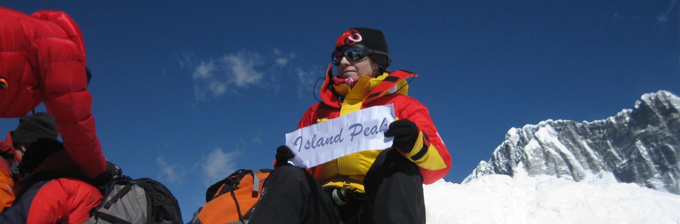
| Island Peak Climbing (Imja Tse) | 17–20 days | Technical & Challenging | Chukhung, Island Peak Base Camp & Summit |
| Mera Peak Climbing | 17–20 days | Strenuous | Hinku Valley, Khare, Mera La, Mera Peak Summit |
| Jiri to Everest Base Camp (Classic Route) | 20–24 days | Moderate to Challenging | Jiri, Junbesi, Lamjura La, Namche, EBC |
Notes for Himalayan Trekking

Trips in the Everest Region — Where Adventure Meets the Himalayas
The Everest region of Nepal, also called the Khumbu Valley, is one of the most iconic and breathtaking adventure destinations in the world. Home to Mount Everest (Sagarmatha) — the highest peak on earth — and surrounded by a panorama of towering Himalayan giants, this region offers a wide range of trips for all kinds of travelers. The classic Everest Base Camp trek is the most famous, taking you through Sherpa villages, ancient monasteries, and rugged alpine terrain to stand at the foot of Everest itself. For those looking to go beyond, the Three Passes Trek adds challenge and spectacular scenery, crossing Kongma La, Cho La, and Renjo La to connect the valleys of Khumbu and Gokyo.
The serene Gokyo Lakes and Gokyo Ri trek leads you to turquoise glacial lakes and one of the best viewpoints of Everest and Cho Oyu, while the Jiri to Everest Base Camp route follows the historic trail taken by Sir Edmund Hillary and Tenzing Norgay on their first ascent in 1953. Adventure seekers can also aim for Mera Peak or Island Peak, both popular trekking peaks offering a taste of mountaineering with mesmerizing Himalayan views.
For culture enthusiasts, the region is rich with heritage — villages like Namche Bazaar, Khumjung, and Thameshowcase traditional Sherpa life, colorful festivals, and centuries-old monasteries. Shorter hikes to Everest View Hotel, Tengboche Monastery, or even just a scenic helicopter tour to Everest Base Camp are great for those with limited time but big dreams.
Whether you’re looking for a challenging expedition, a spiritual journey, or simply to immerse yourself in the awe-inspiring beauty of the Himalayas, the Everest region offers unforgettable trips that combine adventure, culture, and natural wonder.
Everest Region Trekking Packages thats you can book for 2025 & 2026
| Package Name | Duration | Difficulty | Highlights |
|---|---|---|---|
| Everest Base Camp Trek | 12–14 days | Moderate to Challenging | Namche, Tengboche, Dingboche, Everest Base Camp, Kala Patthar |
| Everest Base Camp + Gokyo Lakes & Cho La Pass | 16–18 days | Challenging | Everest Base Camp, Cho La Pass, Gokyo Lakes, Gokyo Ri |
| Everest Three Passes Trek | 18–21 days | Strenuous | Kongma La, Cho La, Renjo La, EBC, Gokyo, remote valleys |
| Gokyo Lakes & Gokyo Ri Trek | 12–14 days | Moderate | Gokyo Lakes, Gokyo Ri, Machhermo, Ngozumpa Glacier |
| Everest Panorama Trek (Short) | 7–9 days | Easy to Moderate | Namche, Khumjung, Tengboche Monastery, Everest View Hotel |
| Island Peak Climbing (Imja Tse) | 17–20 days | Technical & Challenging | Chukhung, Island Peak Base Camp & Summit |
| Mera Peak Climbing | 17–20 days | Strenuous | Hinku Valley, Khare, Mera La, Mera Peak Summit |
| Jiri to Everest Base Camp (Classic Route) | 20–24 days | Moderate to Challenging | Jiri, Junbesi, Lamjura La, Namche, EBC |
 Important Notes for Trekking in the Himalayas
1. While trekking in the Everest, Rolwaling, or any remote Himalayan region, it’s important to remember that some smaller places — such as suspension bridges, single tea-house clusters, or seasonal yak pastures — may not appear on Google Maps or digital maps. These landmarks, however, are well-known to local guides and clearly marked on traditional trekking maps. Trust your guide or a good paper map for navigating these lesser-known spots.
2. The names of villages, passes, and landmarks often have spelling variations, as they are transliterated from Nepali (or Sherpa/Tibetan) to English. For example, “Thyangboche” and “Tengboche” refer to the same place, as do “Bhandar” and “Bandar”. Don’t be confused by slight differences — they’re common and perfectly normal on signs and maps.
3. As you ascend higher into the mountains, the settlements become sparser, and you’ll often find just a single lodge, a basic tea-house, or even a lone yak pasture serving as the only rest point for several kilometers. In these higher areas, it’s crucial to plan your stops wisely and confirm accommodation in advance during busy seasons.
These points highlight the beauty and rawness of trekking in Nepal: it’s an adventure through living landscapes, where maps only tell part of the story and the local knowledge brings your journey to life.
